
We spend the early morning of Tuesday, 7/8/14, attempting to find a location for a shore or zodiac excursion in Hurry Inlet of Scoresby Sound; however, a consistent north wind with strong gusts makes leaving the large ship in a light zodiac a very dangerous proposition. During breakfast, a muskox is spotted in the distance, but it is too far away to meaningfully photograph. The crowd gathers in the ship’s lounge to listen to Pat & Rosemarie Keough tell their story of self-publishing their limited run photo book, Antarctica, which sells for $5000.00 in the ships gallery. The custom stand to display the 35-pound piece of art is an additional $2500.00. It took them years to travel and shoot the photos as well as custom print and bind their book with craftsmen practicing ancient book production techniques.

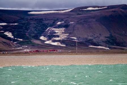

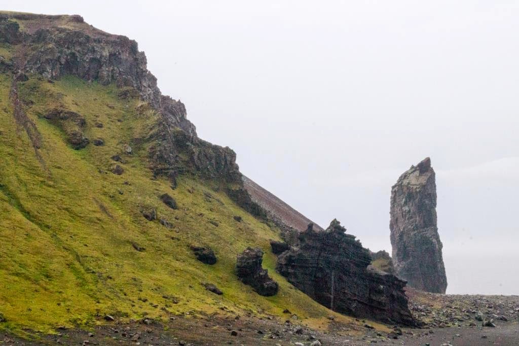
It has often been said that Greenland is a misnomer. This is definitely true of the frigid and rocky east coast. While beautiful, the landscape is certainly not green. The single human development we see today is small and remote. It must be a tenacious people living along this inhospitable east coast of Greenland.


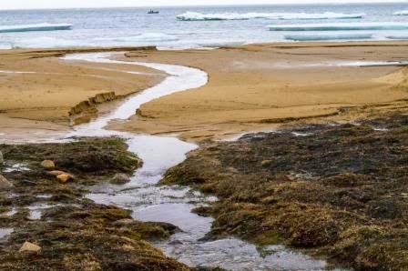
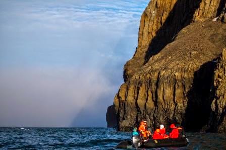
After lunch, we travel to Cape Hooker and make a zodiac landing for a short walk on Greenland’s east coast. The Grosvenor Teacher Fellows (Kelly, Tammy, and I) collect temperature and salinity profiles of glacial melt water, ocean shore water, and 15-meter deep water profiles from both the “brown” waters and “blue” waters we’ve been seeing all day. The data confirms that the “brown” water is colder, lower salinity glacial melt water layering above the blue seawater. Also, the waters off the coast of Greenland are much colder and somewhat higher salinity that those off the coast of Svalbard. This makes perfect sense. Svalbard is bathed in the relatively warm surface current fed by the Gulf Stream, while the East Greenland Current brings icebergs, multi-year sea ice, and return flow cold waters from the Arctic Ocean to our current location.


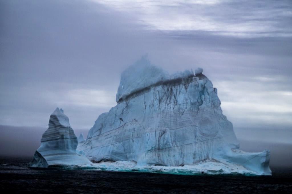
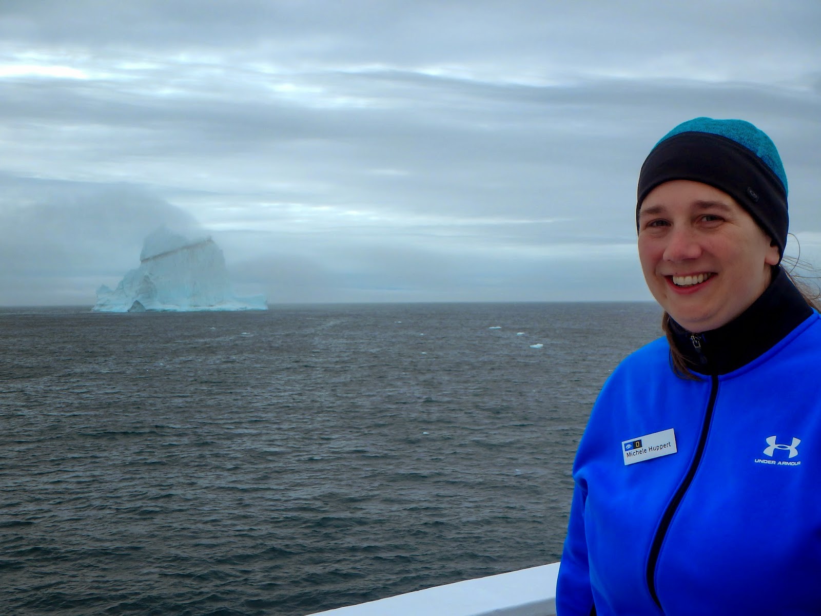
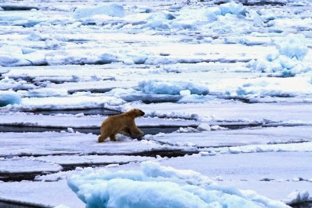
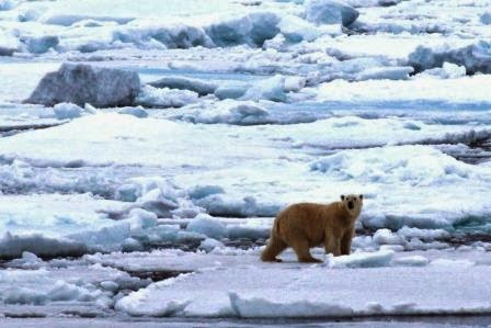
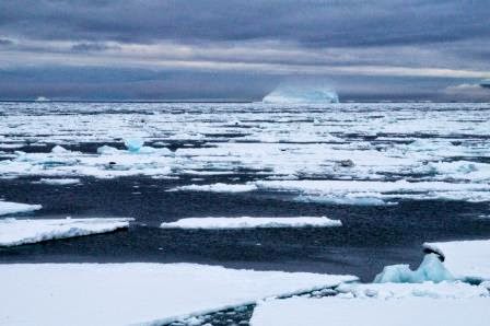
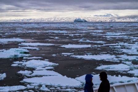
On Wednesday, 7/9/14, we are still in the vast Scoresby Sound, the largest fjord system on Earth. We awake to an announcement that we will do some zodiac cruising among the ice bergs this morning, but during breakfast the fog closes in and we spend another morning watching icebergs from the bow or in the ship’s lounge reviewing Arctic vocabulary, sharing photos of what we’ve seen so far, and learning about Greenland’s east coast. The morning’s conveyance of interesting information is punctuated by bear sightings that cause 150 people to scurry to cabins, collect cameras and warm gear, and rush onto the bow for photo opportunities.


After lunch, we visit Ittoqqortoormitt, Greenland. (That’s not misspelled; it’s pronounced something along the lines of eat-taco-tor-meat.) It is a purposeful settlement started by the Danish in 1929 with 70 people. The current population is 460 people, including 150 children. I work on the Inuit pronunciation of halo (hello), takuss (goodbye), qujanaq (thank you), and itita (you’re welcome) before boarding a zodiac for a ride to the village. We are greeted by children from the local community when we arrive. We have been asked by the community to NOT give them any candy or other things. I can completely understand why the community does not want their children learning to beg visiting strangers for treats, but we certainly wish we could offer them gum or other small gestures of friendship. They are adorable, friendly children eager to practice their English with us. I wander the town appreciating the challenges of infrastructure maintenance in such a harsh environment, watching children play football, and listening to the barking of working dogs.

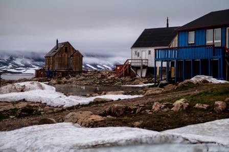


There is a small museum full of photos depicting the history of the settlement, and up a steep and narrow flight of stairs there is a room with mittens made of polar bear fur, reindeer skin pants, traditional fancy dress, and a traditional skin umiak. In my wanderings, I learn from a resident that a ship delivers supplies once each August and once in September because these are the only times in which the ocean is reliably ice-free. A plane brings mail and supplies to the nearest air strip (which is a helicopter ride away) once each week. An apple that arrives on the ship costs 4 kroner (80₵), but an apple brought on a weekly flight costs 20 kroner ($4). Much of the diet here is based on the sea. People fish herring and salmon as well as hunting for seals, walruses, whales of all types including orcas, porpoises, muskox, and polar bears. Many of the visitors watch and photograph a local man skinning an older male polar bear that was shot and bled out yesterday because it was repeatedly coming into the town. I do not. I have no issue with the subsistence life happening here, and I think it is really interesting that people find a way to survive in such an unforgiving environment, but I am glad to not participate in it. Perhaps I’m not really much of an adventurer after all, and I am looking forward to returning to the comforts of family and home in a four days. However, first we will travel along the west coast of Iceland, and I’m looking forward to another stop on the Mid Atlantic Ridge. Maybe we’ll get really lucky and witness some volcanic activity!


After supper, the fog lifts and winds die down a bit. We go on zodiac cruises around a few ice bergs and a rocky island. Both the sea and sky are a beautiful deep blue, and we see a fogbow in the low clouds constantly forming around the ice bergs. It is exciting racing around on the open water, and we are surrounded by majestic mountains in the distance. I took lots of photos, but they can’t capture the exhilaration of the experience.
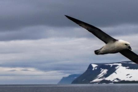
Thursday, 7/10/14, is another day at sea as we travel to Iceland’s west coast. This means the main activities of the day will be naturalist talks and searching for the sparse wildlife in the open ocean. Once we leave Greenland’s continental shelf, we are unlikely to see many marine mammals or sea birds since nothing deflects the deep, nutrient-laden currents to the lighted surface where they could allow diatoms to photosynthesize and lay the base for a food web.
The first talk of the morning is given by David Barnes entitled, “The Irish in Iceland: Celtic Christianity and the Brendan Voyage.” He points out that the ½ million Icelandic people speak a language most closely related to the ancient Vikings and consistently carry the most pure Viking genetics. However, there is also a strong streak of Irish DNA, most likely resulting from early Irish monks who threw themselves out into danger on the sea, trusting that their faith would keep them safe, or Irish slaves of the Vikings. Other talks of the day include one on cetaceans and another on Arctic winter adaptations.


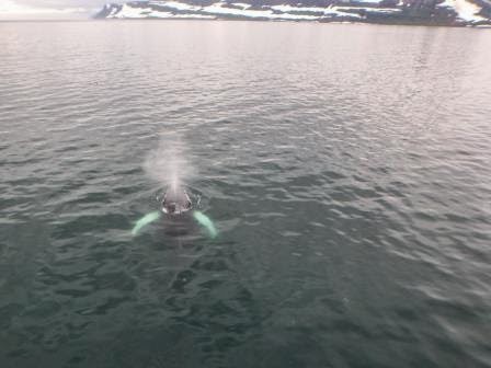
After supper, we approach the northwest shore of Iceland and a half-dozen shallow-feeding humpback whales, including a mother and calf, feed around the ship for an hour. They blow bubble nets, fluke regularly, and swim right up to and underneath our boat. Several puffins and other birds feed in the fluke prints of the humpbacks. The volcanic peaks of Iceland, carved by textbook hanging u-shaped glacial valleys and spouting waterfalls into the sea, set the backdrop for the show. It was an amazing opportunity to observe humpback behaviors, and everyone on the ship seems awed by the experience.


